Mural

U.S. Bureau of Reclamation | San Joaquin River Restoration Program
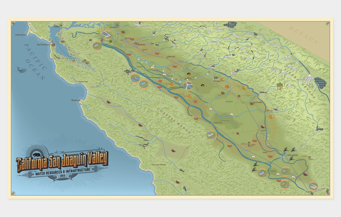
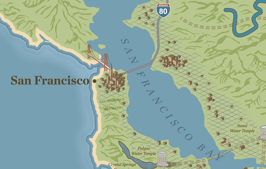
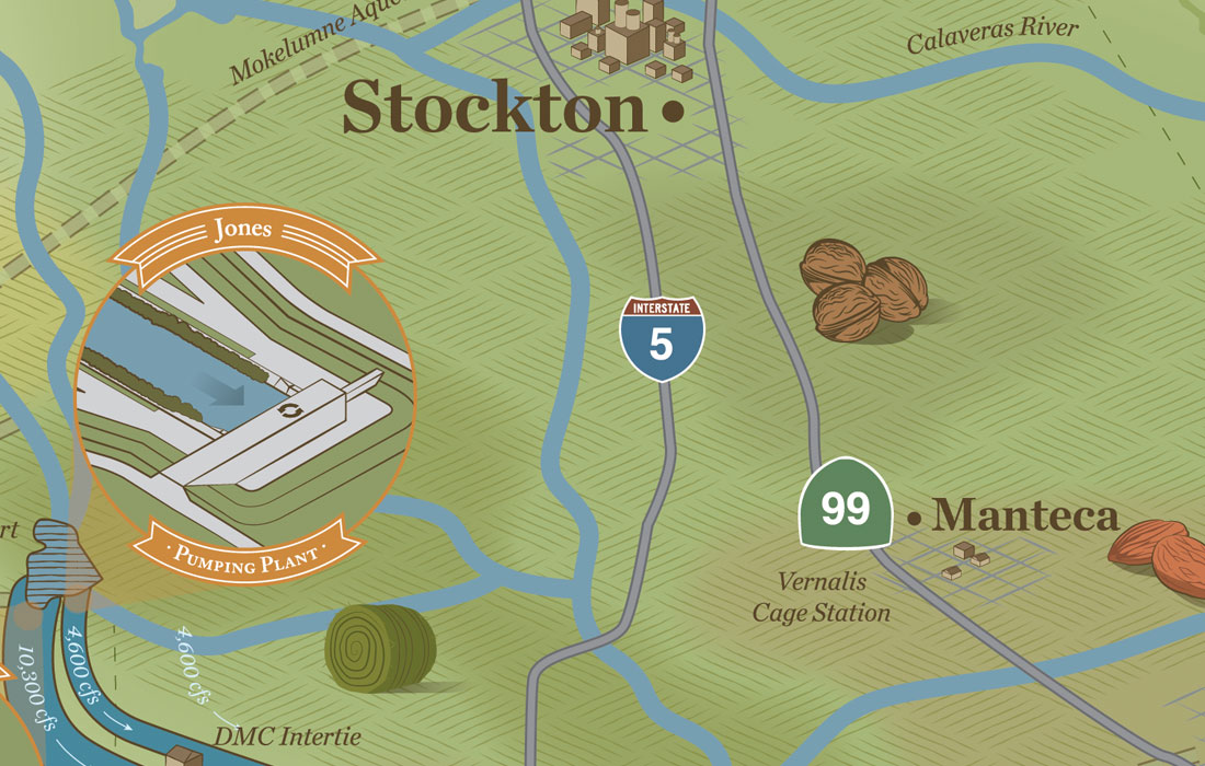
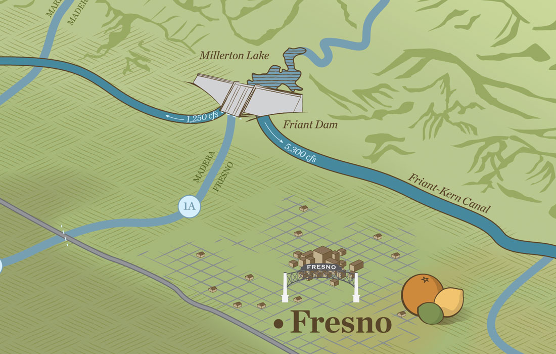
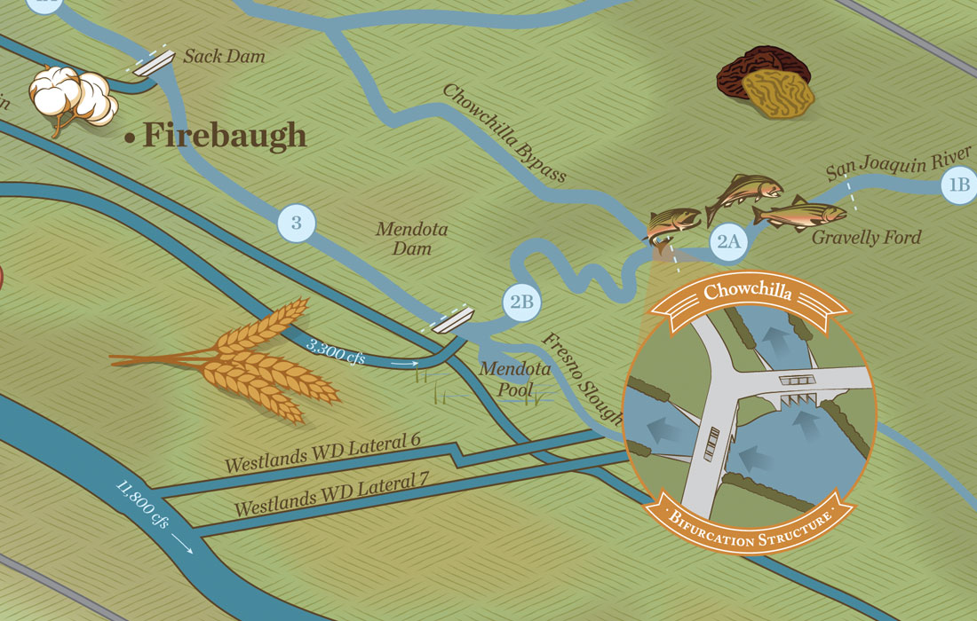
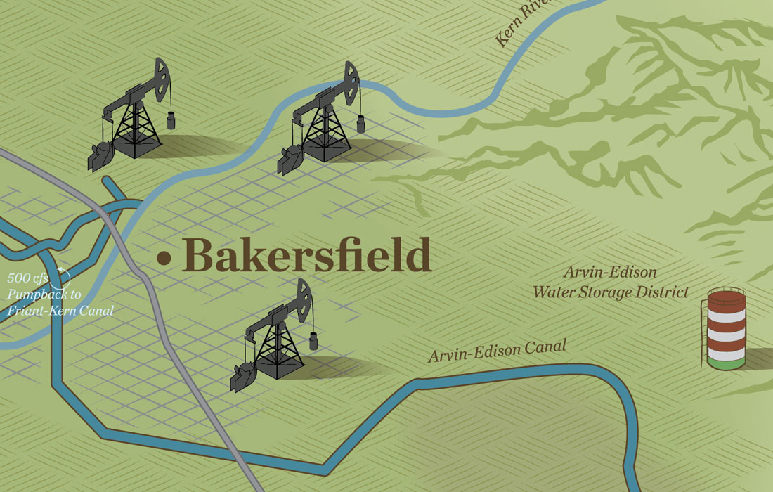
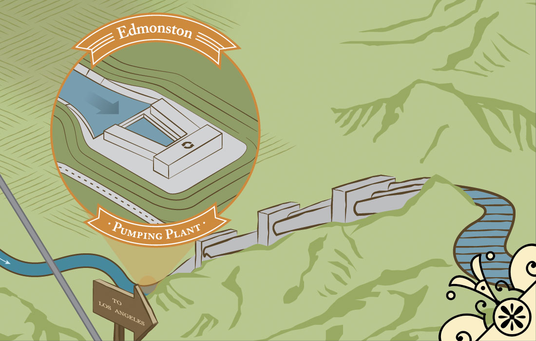
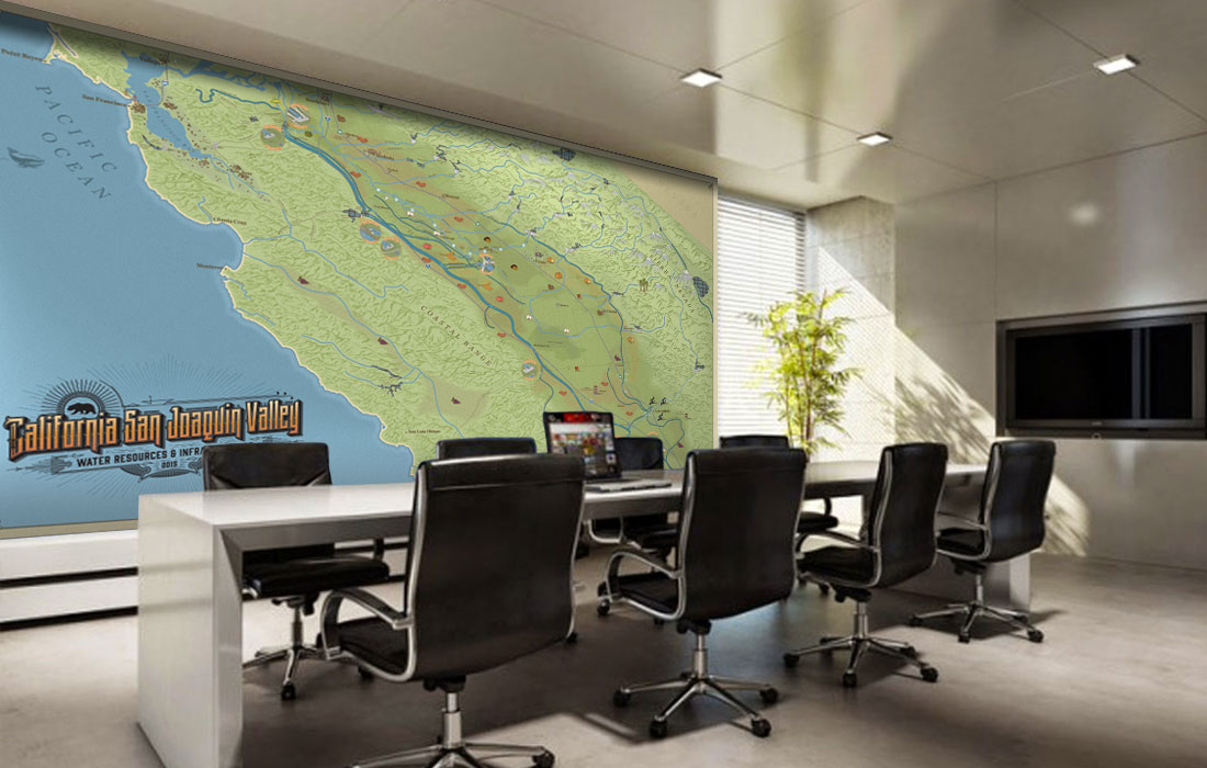
When we were approached to create a large-scale illustration of California’s Central Valley and intricate water system, we knew it would be a major endeavor. Over the course of a year, we incorporated vintage map styling with a modern twist to this 12-foot x 7-foot wall mural to illustrate the geography of California’s water infrastructure and so much more from the Bay Area to Bakersfield. Each element of this mural was hand drawn from a crevasse in a mountain, to specific architecture of dams and pumping stations, to individual whiskers of alfalfa on hay bales. In addition to these intense graphic representations, technical data is also a major part of this map. Cubic feet per second (cfs) flows are shown for all canals, which correspond with data from the State Water Project Handbook, and specific GIS data was used to represent urbanized areas, wetlands, crop belts and topography.
The mural was installed as a permanent, museum style exhibit at the US Bureau of Reclamation offices in Sacramento, California. It was framed and coated with a dry erase coating, allowing the map to be used as an illustrative discussion tool for meetings and planning purposes focused around the San Joaquin River Restoration Program.